Bilateral Meetings
- (9:00 a.m. - 3:00 p.m)
CREATIVE and CULTURAL INDUSTRIES
- Photography, aerial imaging
ENERGY, ENVIRONMENT
- Energy efficiency & saving
- Ecology
- Biodiversity
- Other
MANUFACTURING PLANTS
- Plant control & maintenance
OTHER APPLICATIONS
- Real Estate
- Tourism
- Construction
SECURITY & SOCIETY
- Natural disasters
TRANSPORTS
- Road
VALUE CHAIN
- Service / Maintenance / Supply
Technical inspection
We provide visual inspections (photo & video) for construction engineering purposes at resolutions less than 1px/cm.
- Technical co-operation
- Commercial agreement
UAV remote sensing for agriculture and environment
We do have abilities to offer basic NIR and RGB aerial imaging, to transform the data into environmental indices like NDVI and we would like to push it forward.
Our need is to develop the practical marketable applications in agricultural, forestry and environmental protection segments and thus we are looking for a partner willing to innovate in this respect.
- Reaserch coooperation
- Join research project
- Reaserch coooperation
- Technical co-operation
- Join research project

Photogrammetry 3D modeling
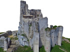
We do offer our abilities to deliver 3D models of terrain and objects (e.g. buildings) for visual presentation purposes as well as for measurment, further conservations or reconstruction works.
Our offer may concern needs of various professionals, among which architects, historians and conservators may gain the most.
- Reaserch coooperation
- Commercial agreement
- Other
Aerial surveying services - orthophotomaps, DEMs
We do offer aerial imaging services from oblique photography, technical inspections to surveing productions like orthophotomaps, digital elevation models, point clouds and GIS analyses.
Having experience in delivering precise orthophotomaps and DEM's we are looking for cooperation with representatives of civil engineering, construction as well as environmental, agriculture and cultural heritage / archeology branches.
- Reaserch coooperation
- Commercial agreement
- Other